How dangerous is cyclone ‘Remal’?
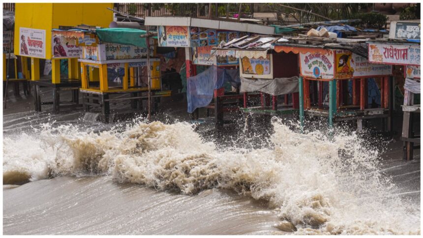
Cyclone Remal will hit the coasts of West Bengal and Bangladesh on Sunday. The Meteorological Department has also issued a warning in this regard. Let us tell you that this is the first cyclone of the monsoon season in the Bay of Bengal, which has been named Remal. The wind speed can be 102 km per hour when it hits the coasts of West Bengal and Bangladesh. Let us tell you that heavy rains are expected in the districts of West Bengal including North Odisha, Mizoram, Tripura and South Manipur on 6 and 27 May. According to meteorologists, the cyclone is moving forward rapidly due to the warm temperature of the sea surface.
What does the word “Remal” mean
The word Ramal, derived from Arabic, means sand. According to the Bureau of Meteorology, a special kind of situation is responsible for this type of cyclone. This cyclone is formed only when the temperature of the sea surface exceeds 26.5 degrees Celsius. During this time, the hot and moist winds start rising. As the winds rise upwards, a low pressure zone starts forming below. During this time, the pressure on the low pressure area starts increasing due to the surrounding winds and a cyclone is formed. The heat of the sea surface plays an important role in the formation of this cyclone. In simple words, the increase in the temperature of the sea surface gives more energy to this cyclone.
How dangerous is cyclone Remal?
One of the specialties of this cyclone is that wherever it passes, there is heavy rain and winds. The effect of this cyclone can last for a week. The power of this cyclone can be estimated from the fact that it has the capability to bring down even strong poles and large electricity poles. It can also uproot trees from their roots. Due to this, traffic is affected and there can be loss of life and property. Let us tell you that due to heavy rains during this period, a situation like waterlogging arises.
Latest India News