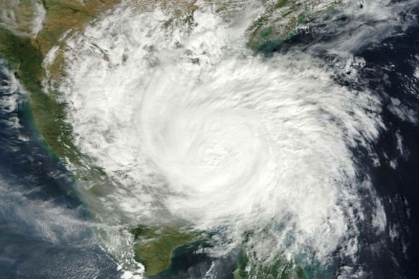
new Delhi. Light to moderate rain, heavy to very heavy rainfall very likely to occur at most places over Nicobar Islands on Friday, March 21, as a cyclonic storm is very likely to make landfall in southeast Bay of Bengal. The India Meteorological Department has experimentally projected the pre-origination track and intensity forecast in the phase of the LPA over the southeast Bay of Bengal. It is the first center to introduce pre-origin forecasting worldwide.
The LPA moved east-northeastwards over central parts of south Bay of Bengal and lay centered over southeast Bay of Bengal and adjoining east equatorial Indian Ocean on Thursday morning. It is likely to move east-northeastwards. By the morning of March 19, it will lie over the Bay of Bengal and adjoining South Andaman Sea. Thereafter, it is likely to move forward. It will turn almost northwards along Andaman and Nicobar Islands, into a depression by the morning of 20 March and into a cyclonic storm on 21 March.
Thereafter, the storm is very likely to move approximately north-northeastwards and approach Bangladesh-North Myanmar coasts around the morning of March 22.
The IMD said that after light to moderate rainfall, the Nicobar Islands are very likely to receive thunderstorms at most places with heavy to very heavy rainfall at isolated places on March 18. Very heavy rainfall is likely over Nicobar Islands on March 19.
The IMD has also issued a strong wind alert and in view of the rapidly increasing movement in the sea, fishermen have been advised not to venture into the sea around Andaman and Nicobar Islands till March 21.
—AnyTV News
read this also – Click to read the news of your state / city before the newspaper